Welikia
Recreated
What did New York City look like before European settlement – when it was called Welikia?
Hypothetical turned detailed ecological data into visuals to answer that question.
The Welikia Project is the creation of Dr. Eric Sanderson and colleagues at the Wildlife Conservation Society. Its goal is to create a comprehensive set of data describing the ecosystems of New York City before it was New York City. Information about the thriving ecosystems that existed before the arrival of European settlers and the hundreds of years of urban development that followed can be used to make smarter decisions for future development.
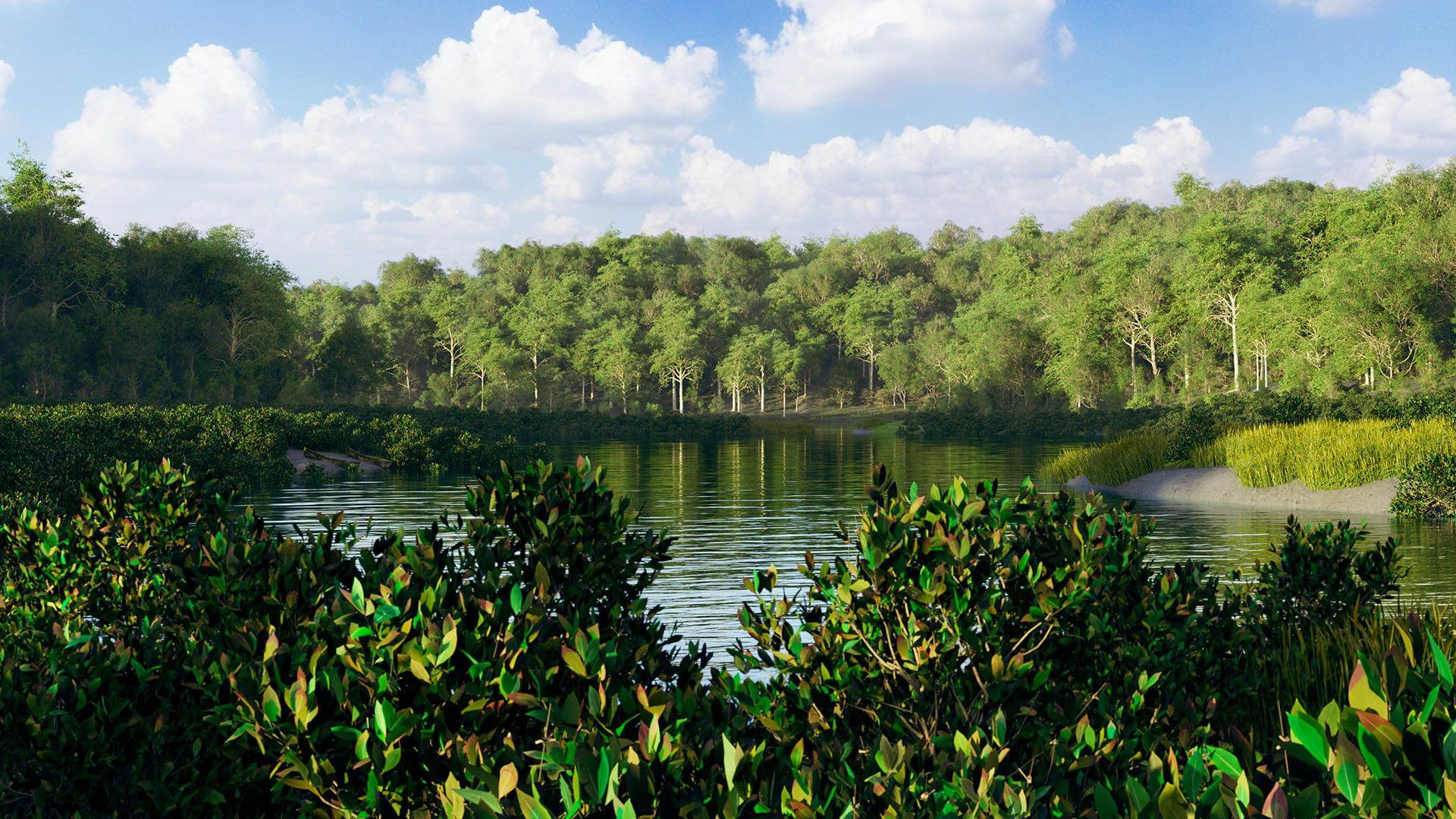
Hypothetical had the privilege to interpret the Welikia data as striking visualizations. Starting from detailed information about elevation, ecosystems, water features and more, Hypothetical created a digital world with millions vegetation models and detailed landscapes. The result is a collection of vibrant images that jump off the screen and take viewers on a journey back in time.
Rendering Large Landscapes
Dr. Sanderson came to Hypothetical with a variety of goals for the visual recreation of Welikia. The area his data covered is almost 700 square miles with bathymetric information included. About a third of that area is above water and would need to have vegetation and landscaping, making for roughly 230 square miles of visible terrain.
Hypothetical’s goal was to make that 230 square miles detailed, realistic and beautiful. Handling the vast amount of data from the Welikia Project and the even greater amount of data generated during the rendering process would be a challenge. To tackle it, we created a customized software solution built on Gaffer, an open-source visual effects program that has a track record of handling large data sets for Hollywood feature films. This allowed us enormous freedom to optimize the scene generation and rendering process without sacrificing quality and accuracy.
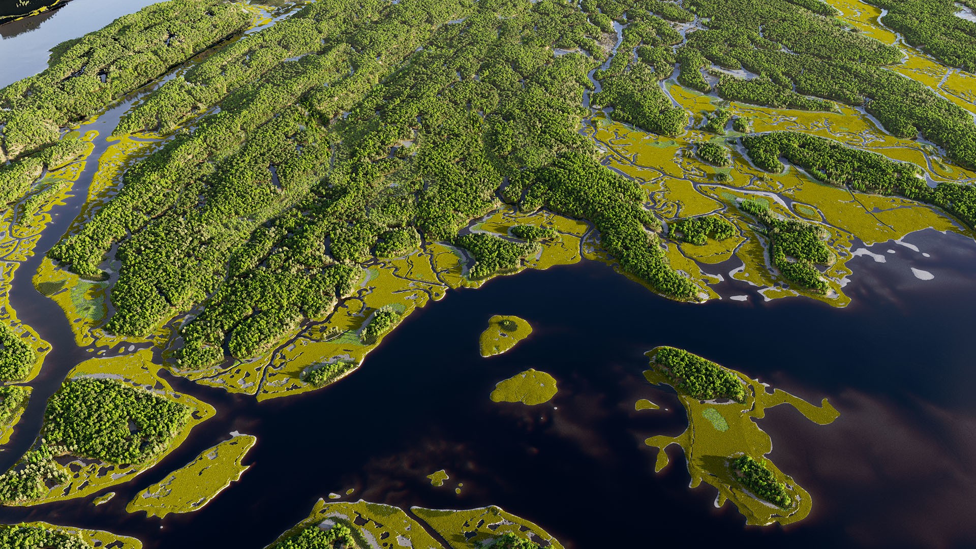
One of the recurring challenges in creating realistic visual effects is making imagery that looks natural. The 5m resolution elevation data from the Welikia Project worked great for long distance views, but when seen from ground level it looked too smooth. This was a wild landscape that had experienced very little human intervention from the Lenape people. So we added a subtle layer of detail by simulating erosion across the landscape – peaks were worn away slightly, valleys accumulated silt and soil was slumped down steep sides. We didn’t want to touch the original data any more than needed to give a realistic effect and the result was a more natural looking terrain at 1m resolution across the entire 700 square mile data set.
We also incorporated 3d scanned materials and textures for the most realistic look possible. Mats of dried leaves cover the terrain under the trees, wet sand extends out to the sea and damp mud coats the ground throughout salt marshes.
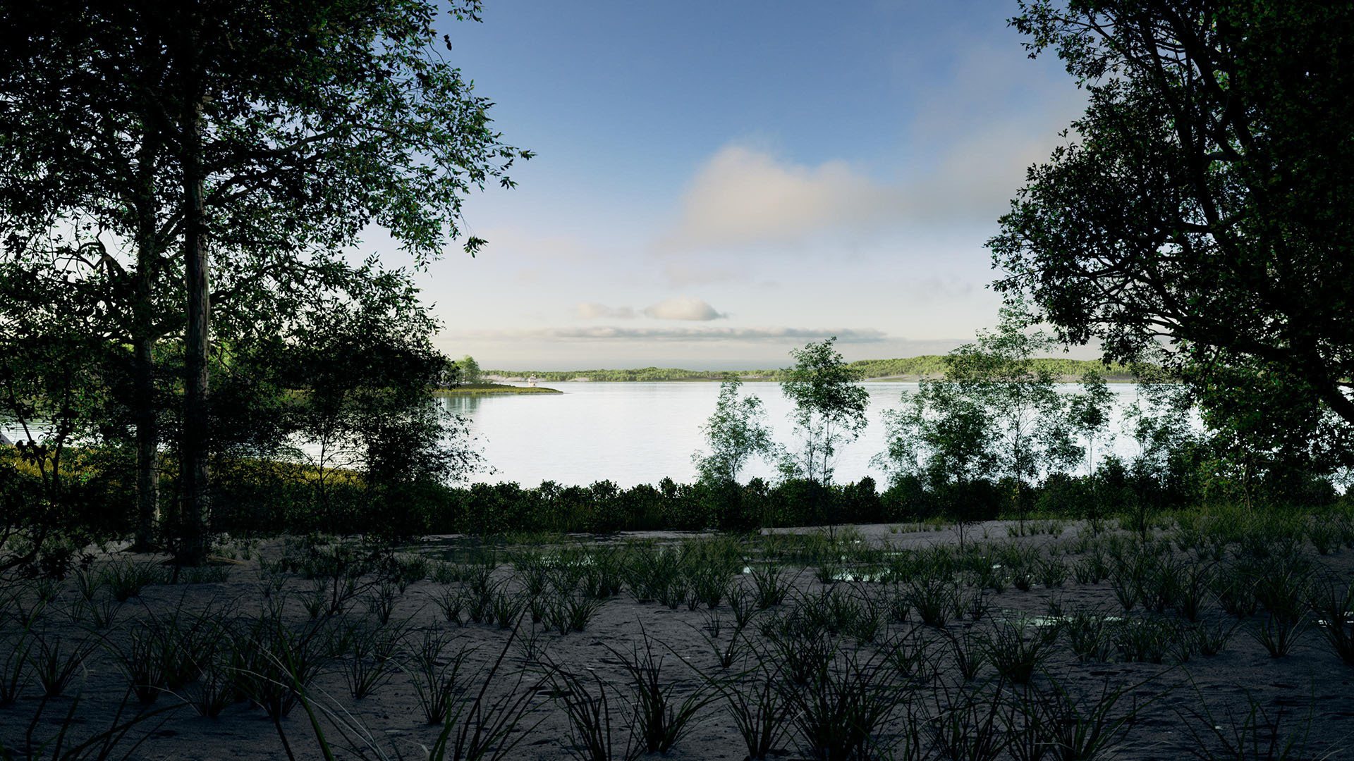
Another requirement was the ability to see Welikia from at least three distinct classes of viewpoints: a satellite view, a birds-eye level and a ground level view. These three types of views require very different amounts of detail in the vegetation and terrain. At satellite distances grass and small bushes become green dots that need to be fully detailed leaves and branches at ground level. Birds-eye views offer a combination of details – closer items need to be fully resolved but the horizon is often very far away and the overall view can encompass tens of thousands of acres of land.
Hypothetical’s philosophy of creating one world to explore with cameras, lights and set dressing solved these challenges and opened up new possibilities. Our approach was to create a single world that could be viewed from anywhere – without restrictions on camera location or special-case handling for different viewpoints. It also allows the exciting ability to create animated scenes – with consistent placement of objects in shots, Welikia can be explored just like a cinematographer would the real world.
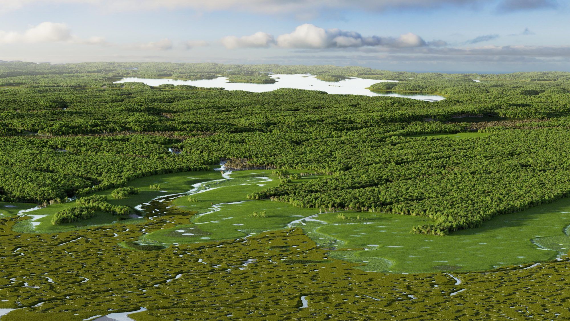
In keeping with the one world style of scene building, we decided to take full advantage of modern rendering technology and cloud computing resources and keep all of the vegetation models at the same level of detail. That means when you are looking over a Queens salt marsh from 1000 feet above the ground, each individual blade of grass and every tree leaf is still present in the scene.
Finally, we needed to be able to specify viewpoints using latitude and longitude coordinates. Though it sounds like a small feature, it’s extremely useful to be able to link the world of Welikia to modern day tools like Google Maps. Hypothetical’s customized software solution for rendering Welikia made integrating latitude / longitude coordinates simple and greatly improved the process of communicating camera locations to one another.
Rendering Lots of Trees
Welikia was a lush landscape, so representing that in a dramatic way was key to the success of the imagery. The Welikia project generated information about ecosystems in a way that classified individual map cells as one of almost 60 different ecosystem types. Hypothetical’s procedural plant distribution algorithm used those classifications to scatter appropriate plants within each cell.
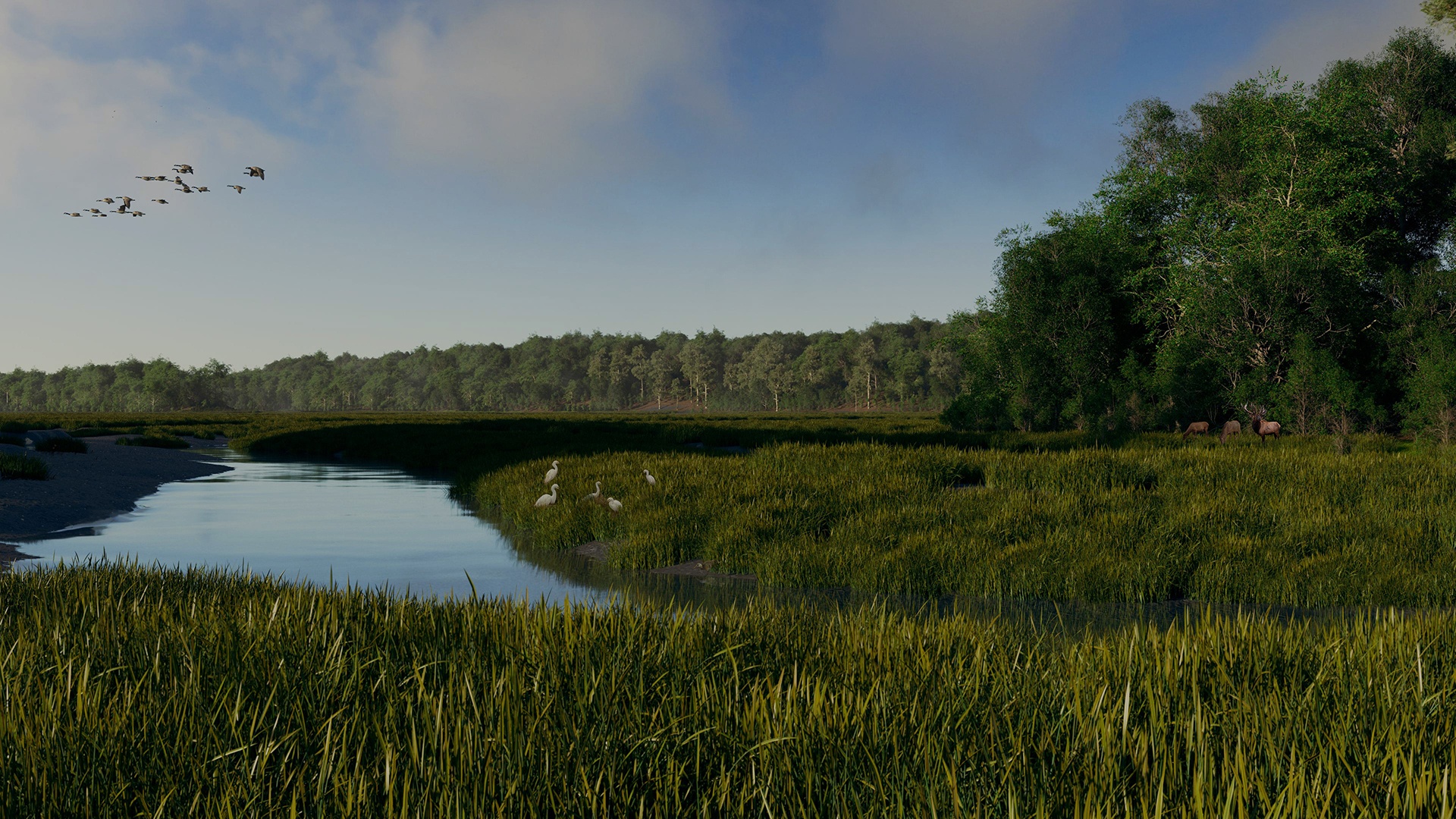
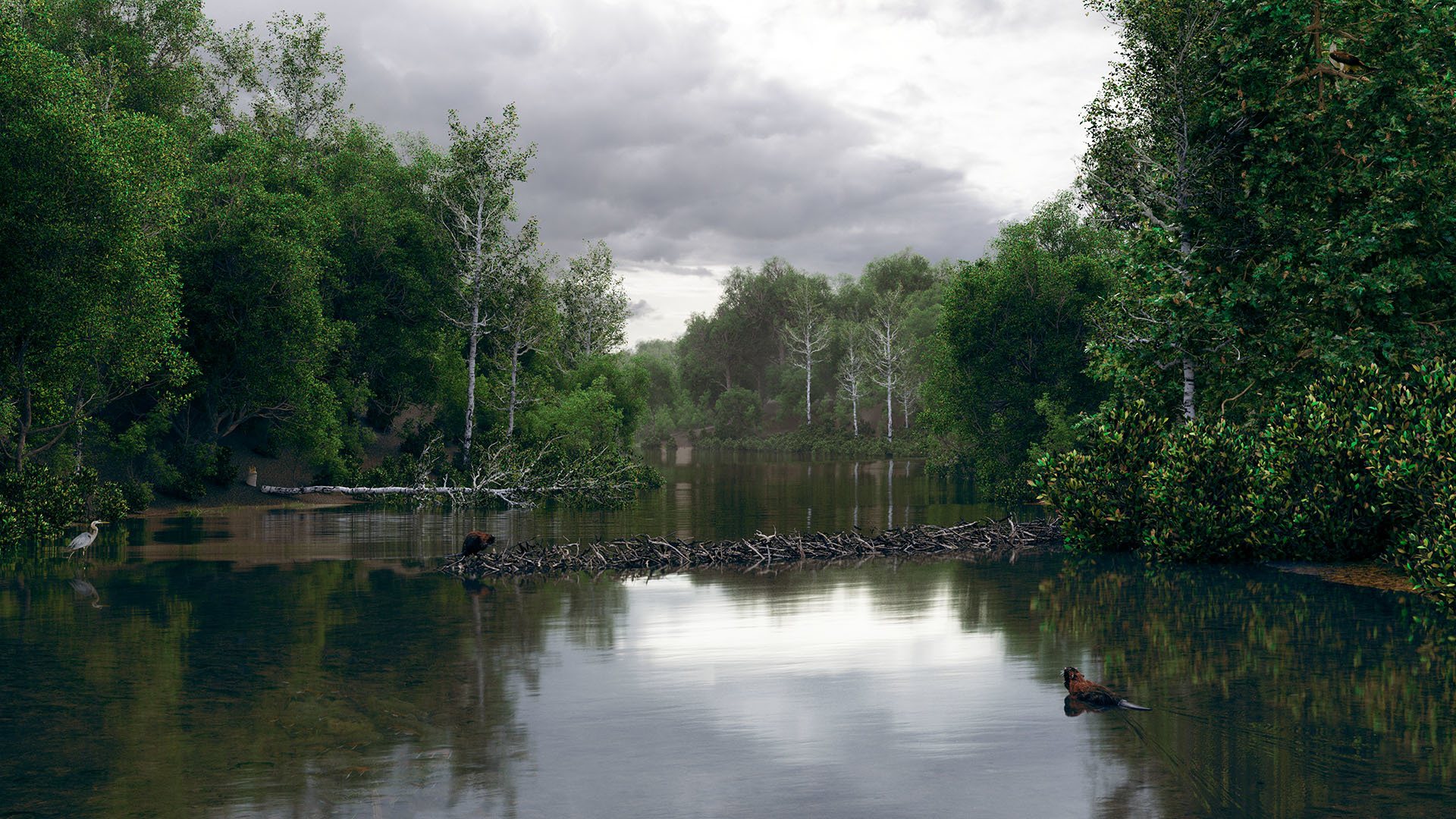
The algorithm also took into account relationships between individual vegetation pieces. A coastal oak-hickory forest includes those two trees as the dominant species, but also smaller dogwood trees scattered through the understory. Even closer to the ground is a sparse collection of grass where just enough sunlight comes through the canopy to reach the ground. And Welikia, having been hardly touched by human hands, was an old-growth forest. This meant the trees would be quite varying in their trunk thickness. The edges of the forest would also be thick with leaves where the extra sunlight was available.
Our system took all of these ecological details into account – top-heavy trees in the center of forests, thicker trees at the edge, dense grass throughout the salt marshes, and much more. And all of these things spaced naturally apart from each other or clustered according to their natural growth patterns.
But some shots, especially at ground level, require an artistic touch that can’t be generated from algorithms. To accommodate this we added a tier of customization on top of the procedural algorithms that let artists adjust individual vegetation locations and add unique animals and plants. The result is a two-stage scheme that can populate huge areas without giving up artistic control.
Old New York vs New, New York
It’s fascinating to look at satellite views of Welikia overlaid on modern day street and transit layouts. In this composite of lower Manhattan, you can easily see where Canal Street got its name. There’s also a nice clearing in the trees where 34th Street now runs. The Brooklyn-Queens Expressway runs along a former salt marsh. The satellite view also demonstrates why the location of the Brooklyn Bridge, and the Fulton Ferry service that preceded it, was chosen. The points on the Manhattan and Brooklyn sides are at their closest approaches that also avoid the salt marshes.
Manhattan Today vs. Welikia


Maps © OpenStreetMap
Brooklyn and Queens also have an interesting distant history. It’s easy to see the Last Glacial Maximum – the most southern extent of the last glacial period that cut valleys across North America. It’s the ridge running left to right in the overlay below and corresponds precisely to Jamaica Avenue and part of the J Line. South of this ridge is a long gentle slope to the ocean that still includes salt marshes today.
The sporadic passes across this ridge line are also visible here. Revolutionary soldiers defending New York against the British who were trying to reach Manhattan from Long Island left these passes unguarded, allowing British forces to pass through unchallenged. It wasn’t long before the British took New York and held it throughout the Revolutionary War.
Brooklyn + Queens Today vs. Welikia


Maps © OpenStreetMap
It turns out that a lot of New Yorkers and others are captivated by the long-lost history of New York. Michael Kimmelman interviewed Dr. Sanderson in the New York Times for a pair of virtual walks through Welikia, and Hypothetical had the honor of contributing visuals for the pieces.
What’s Next
Hypothetical’s journey through Welikia with Dr. Sanderson and his team has been a real adventure. But it’s not over yet. There is always more detail and diversity to add, more animals to create and more productions to take on in such an extensive and captivating world. And we can’t wait to keep exploring.